Dolomites (Alta Via 2)
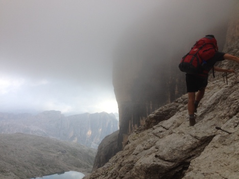
After my trek along Glyndwr’s Way earlier this summer I returned and proclaimed it one of my hardest walks. There was wind, rain, endless hills and little facilities. That trail now seems like child’s play in comparison to what I have just returned from. For while on Gylndwr’s Way I might have got a bit wet, my life was never dependent on a rusting iron cable suspended across a cliff face at 3,000 metres.
I had wanted a step up, and by going to the Dolomite Mountains I not only took that step but probably skipped about 3 or 4 in doing so.
My friends and I had chosen to walk the Alta Via 2 (High Way 2), a 150km, waymarked trail from north to south of the Dolomite range in far north Italy. There are eight ‘Alta Via’ in total, each supposedly ranging in popularity/difficulty. We decided against the classic, touristy AV1 and settled for the level above, labelled ‘moderate with some difficult sections’. Three boys at their peak, all experienced walkers- easy. The catch was that though we are experienced walkers, climbers we are not.
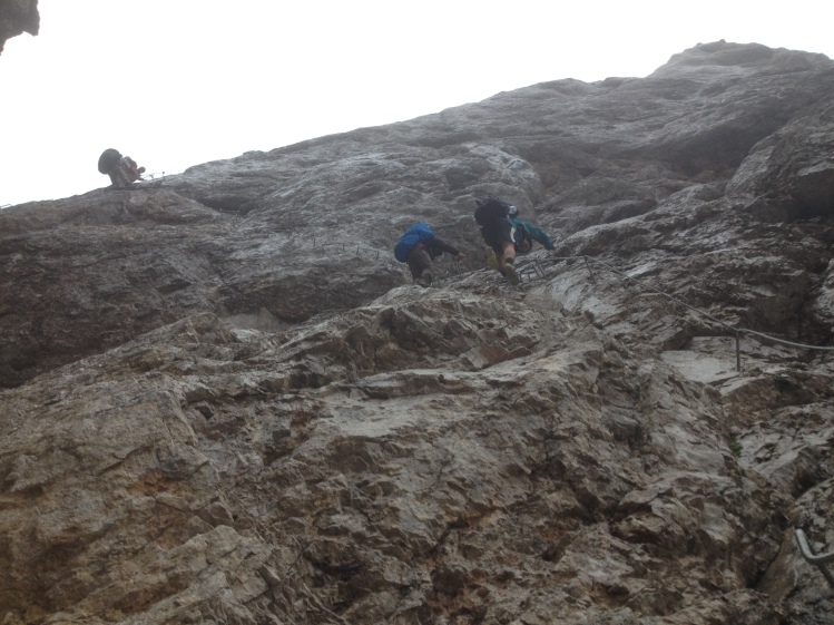
The trail passes through some fiercely fought passages of the Great War, where the Austro-Hungarian and Italian army were battling each other, the weather and the mountains for four years. To get the edge over their opponents, they literally went over the edge, building the Via Ferrata (Iron Ways) over the peaks and cliffs- iron ladders, cables and rungs jammed into the rockface. Many of these still exist, and little did we know that we would be clinging to them for dear life every day. With no harnesses, no crampons, just 15kg bags hanging off our backs.
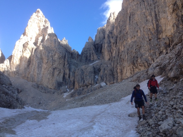
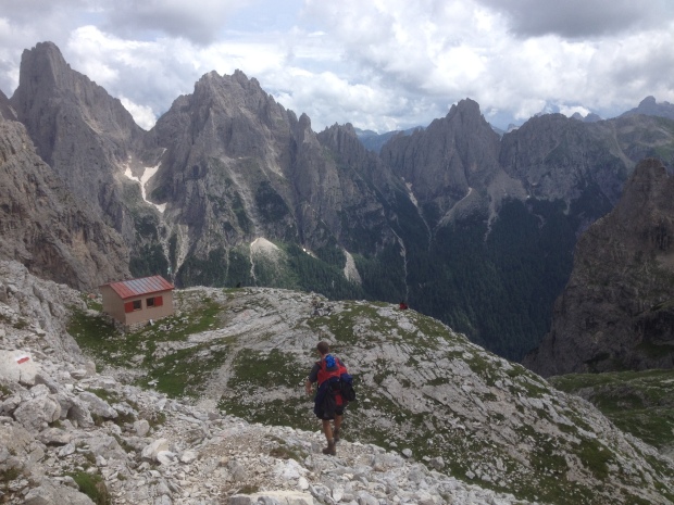
Spending what must have been 80% of the trip at over 2,000 m, there was also ice and snow to contend with. Italy has had a cold summer and many parts of the path were covered with drifts angled across the slopes on which walking boots just did not cut it. The rest was on scree that had crumbled down from the termite hill limestone peaks above that we would eventually need to go through.
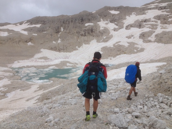
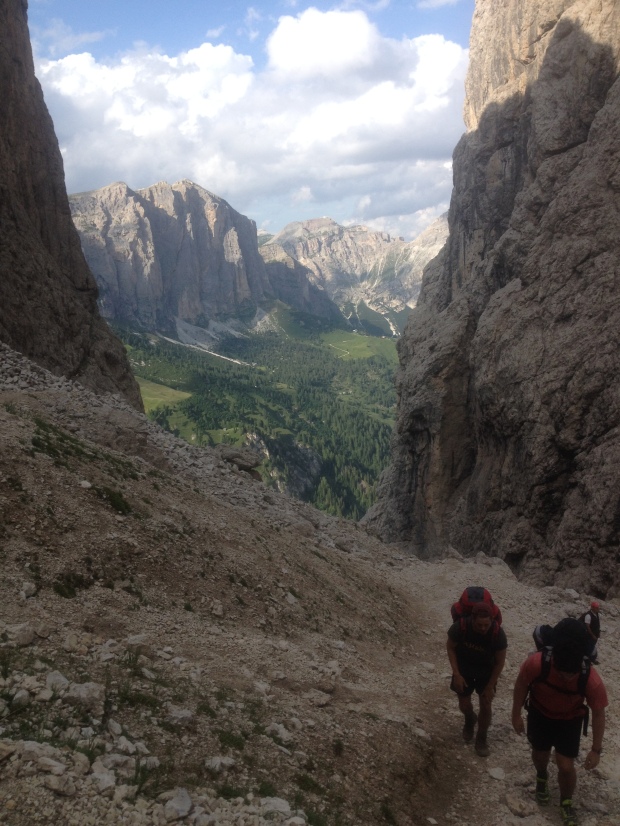
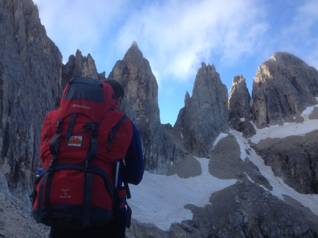
The challenging path and Iron Ways did however open up an inaccessible landscape to give views of one of the most incredible ranges in the world. The highest peak of the Dolomites, Marmolada (3343m), seemed nearly always in view, whilst from on the mountain itself you could see the spiked, snow capped peaks in all directions, all grey from a distance but turning a rosy pink or even light sand colour when up close.
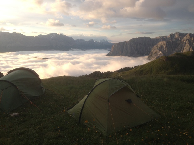
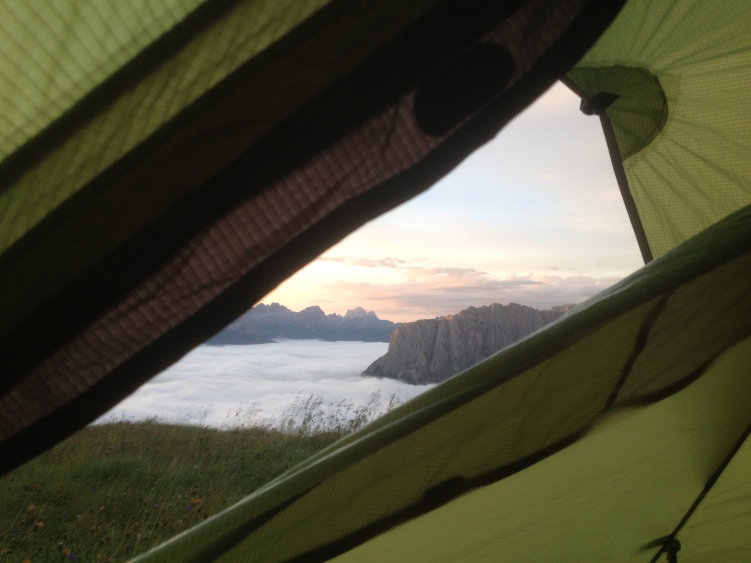
We tried to make the holiday as cheap as possible and therefore carried our accommodation and food on our backs. It turned out to be the right idea, for the path remains high and on very few occasions passes any civilisation let alone shops. There are however, many ‘refugios’, mountain top lodges that offer a bed and food for around 45 Euros. We chose to avoid the expenditure, instead often camping nearby them so as to warm ourselves up with their Grappa (a very, very strong spirit) and chat about the day ahead with fellow trail walkers. It meant we got some incredible views from our beds early morning….
The few times we slept indoors were in the two alpine huts we passed, both unattended sheds with bunks inside. The bunks eventually filled up with tired walkers and food was all shared out amongst each other. Though we had no common language we all had a common appreciation for Grappa.
We were unfortunate with the weather, with rain on most days and low temperatures for an August in Italy but you never know what you’ll get with mountains. Reaching the end at Feltre after eight days, through a combination of the poor weather, the self subsistence, the cliff dangling and the fact we had climbed higher than Snowdon each day for eight days- it felt like one of the greatest accomplishments of our lives.
How to walk it
Don’t let my account put you off walking this trail. Our problem was the lack of technical equipment- perhaps in hindsight we should have taken a harness, perhaps crampons or at least walking poles to steady ourselves on the icy slopes. These would be purely for reassurance and would not be a complete necessity in summer. A certain degree of fitness, is however very necessary.
When to walk
Late June, July, August or early September. We walked mid August expecting it to be too hot- if anything it was too cold. So always be prepared for the extremes whenever you go!
It took us eight days, with no rest days, just continuous walking. Allow yourself 10 if you want to take it easy or nurse a Grappa hangover.
What do I need?
Either a reasonable budget to pay for the beds and food in the refugios or a strong back to carry your food and equipment as we did.
Technical climbing equipment if you want reassurance on the Via Ferratas.
Thick fleece and wet weather gear.
Maps- it’s a well marked trail but knowing what is ahead is important. You can find them along the way- keep an eye out for Tobacco’s maps.
How to get there
We flew from Luton to Venice via Easyjet (return £200) and took a train from Mestre (just north of Venice) to the start at Bressanone for 20Euro.
At the end at Feltre we caught the train back to Venice for 7Euro.




Hi. I really enjoyed your recap, thank you for sharing.
I am looking for a trek this summer and I have been stumbling upon the AV2 for quite some time now. Until now, I thought it was prohibited to pitch a tent, even near the refugees. But then I fell upon this blog, describing how you camped in the wild for most of the trek. How do you recommend going on about that? I am solo trekking, fit to carry all the equipment (might be a problem with the via ferratas and heavy weight), but I wanna keep it on a budget. I might consider eating at the huts, but pitching a tent will be a must.
Hi Christopher. I’m glad you liked it and hope it’s helpful enough.
In terms of camping, it’s such a wild trek that you won’t have trouble finding a pitch at all. In most cases we tried to keep away from the refugios but we once pitched with a few other people right outside one and had no problems- they even gave us boiled water inside for our dried meals.
Eating at the huts is a good idea if you have the money. We encountered very few shops along the way so you’d need to carry a lot of food otherwise. And yes you want your pack to be as light as possible for the via Ferrata sections – for which id also recommend a harness, of which we didn’t have!
It’s a very steep walk with a lot of climbing but one I would very much recommend.
Perfect! I just bought a harness and lanyard, meaning this will be the trek this year. Is it possible to buy breakfast and dinner from the refugies to bring alone, or must it be eaten at the refugee?
Also, you completed it in 8 days. How hard did you push and how long walks did you manage daily? I like to walk for long hours and do not want to have too much time to spare from finishing until the plane leaves. I do not suppose one stage will take a whole day to complete if walking for long hours, so did you double any stages since you finished faster than the estimated time?
Hi,
Yes, most of the refugios have food you can take away with you. We normally found we came across one during the morning and would stop for breakfast.
In the 8 days it took we walked pretty much all day. From about 7.30 to about 8.00. I think a lot of the sections we might have doubled yes. There was one day when we only walked half a day due to bad weather.
If you like long days then you shouldn’t have trouble with 8.
Awesome. Thank you so much for helping me out! I probably would have taken another trek if it was not for you. I am glad it did not come to that 😉
Glad to have helped you make your decision!
Hi Will,
Nice article, I have been out to the area a few times rock climbing but the idea of the Alta Via 2 appeals as a camping backpack. Can I ask, did you find reasonable water sources on the way? Did you buy water from huts or were you able to find enough natural sources?
Also did you manage the western route round the Marmolada to the Forcella Marmalada, without any technical gear?
Thanks very much
Brian
Thanks Brian. I would definitely recommend this as a backpack. Is a tough one though!
In terms of resources , there are little to no shops but plenty of refugios each day that you can buy a meal at or pick up resources from. we got our water mostly from these- at no charge.
They’re quite admirable actually as they dont seem to be trying to make money from you at every turn and are happy to help.
I think Marmolada was the only section we wished we had equipment for. At least a harness and clip anyway. We got away without them, but we of course could have regretted it!
Hi Will, Sounds good with the huts providing water. We are thinking of going out the 1st 2 weeks of August. On the Marmolada west traverse, what was it like climbing up to the col over the glacier? Others have recommended taking full glacier kit (ropes, crampons, harness) for that bit. But it would make it a lot easier for us to not carry that gear as it seems you did. Did you see a lot of crevices or feel you needed glacier kit there?
thanks again for your help
brian
Pingback: Pyrenees backpacking | Walking Wales
Hello, this is a great read 🙂 I’m thinking about doing this route with a friend this summer. Neither of us have done that much hiking but are physically fit and do lots of sport and I’ve done lots of cycle touring so am used to doing exersice and camping for extended periods of time but do you think this route is too ambitious? We do like to challenge ourselves we are going to do a shorter hike in the UK during easter to get an idea of what it could be like.
I really want to do a route where camping wild would be a possibility so do you think it works fine to camp wild? would refuges generally allow you to camp outside or nearby if you can’t find anywhere else? and is the ground not generally too steep/rocky for camping or is it fairly easy to find a pitch?
Hi Jakob, I’m glad you liked it and found it useful.
It sounds like you’d be fit enough. Though if you aren’t used to hiking you might find the first two days a bit tiring as your body adjusts.
We camped several times outside refuges and had no trouble. They would even give us boiling water and bowls to eat our camp food inside… so long as we bought a few beers! Otherwise wild camping is easy to get away with, we had no trouble with pitches.
My main bit of advice is that if you aren’t planning on eating at the refuges, make sure to bring plenty of food. There aren’t that many places to restock – in fact we only came across one super market.
Hey Will – stunning pics and a great post!
I’m looking to take on AV2 next week with a friend, and we then plan on hiking further across the alps potentially over a number of weeks. Like you, the idea of carrying our own accomodation is an appealing one (mainly to save money, but also to be at one with nature, of course!), but I am slightly concerned about finding suitable places to pitch up. I am torn between taking a small tent (non free-standing) or a simple bivvy bag and tarp. I notice in the above comment that you had no trouble with pitches… Was this true for the whole journey? And do you have any further tips/advice on that?
Or, do you think it would be easier to go with a bivvy/tarp combo?
Any advice would be hugely appreciated.
Cheers,
Jonny
Hi Jonny,
You’ve got a good trip ahead of you. I hope the weather is kind for you – it wasn’t particularly good for us despite the fact we walked in August.
There are a lot of rocky sections but you shouldn’t have trouble finding soft, level ground. I don’t recall ever having to spend a long time looking for a pitch and we had two tents between us so needed a good bit of space.
I was going to take my tent without the inner and in the end was very glad that I eventually decided against this as the ground was always very wet. It wouldn’t have been comfortable. If you’ve got a good bivvi and you’re used to it, then it should be fine.
Let me know if you need help with anything else.
All the best,
Will
Hi Will, thanks for the blog – it has definitely changed my approach and made me think more about camping. You’ve answered lots of questions on camping, but I have a couple more:
were there others camping too, and how were other walkers to you?
So far my experience is that it is really easy to meet people and as I am going solo I would like to meet some people en route, and if I am camping solo, I would like to know you came across others camping too?
Also with via ferrata and bulky bags, was this ever a problem?
Hiya, thanks for the blog – it has made the idea of the trip more affordable! I am going to try do a mix of rifugi and camping, and have a couple of questions to clear things up.
I’m assuming that most rifugi are happy to give water if you are passing, but how did you gauge asking whether you could camp nearby?
There are also a couple of Bivouacci en route – did you use them?
Finally, I’m aware that weight is an important factor, but how about bulk? were you ever impeded along via ferrata because of the size of your rucksacks?
Thanks Will!
Hi,
Glad it has helped! A mix of accomodation is a good idea, pretty much how we did it. The remote refugi seemed absolutely fine with camping outside, I think it’s because they expect more times than not the campers will still be coming in for a few drinks or for some food. Best thing to do is go in, order a drink and then ask about tents. It’s easy to spot the more commercial ones and with these we just pitched further along the trail. They will always let you have water (in some cases they gave us boiled water for our instant meals!)
I didn’t come across any bivouacci.
In terms of bulk, I’d say you want a slim pack. There are a few very narrow squeezes between boulders – therefore I’d make sure you’ve got room for your tent and roll mat inside your pack rather than outside. Best to go for an alpinism approach.
Hope this helps. Let me know if you have any other things you’d like answered.
Will
Hi Will.
Amazing blog, I have had a hard time finding info on camping and alta via 2, but when reading your post it gave a lot of valuable information. I am going there next week with my best buddie and have a couple of questions:
– Temperatures doing the night – I cant figure out the kind of sleeping back to bring, how cold did it get?
-We are also on a budget, what would you say the average prices are for an evening meal – just the food.
-Would you recommend bringing rain proof pants as well?
Thank you so much,
Kind regard Christian
Hi Will.
Amazing blog, I have had a hard time finding info on camping and alta via 2, but when reading your post it gave a lot a valuable information. I am going there next week with my best buddie and have a couple of questions and would appreciate your thoughts:
– Temperatures doing the night – I cant figure out the kind of sleeping back to bring, how cold did it get?
– We are on budget as well, what would you say the average prices are for an evening meal at the refugees – just the food.
– Would you recommend bringing rain proof pants as well?
Thank a lot,
Kind regards
Christian
Hi Christian.,
I’m really sorry I didn’t get back to you sooner. I assume you’ve already gone!
I took a -3 rating down sleeping bag and it did the job. Temps didn’t get too cold. I can’t really remember the prices in the refugi but I think they were quite expensive. We brought dried foods and often asked the refugi if we could get boiled water from them!
I didn’t bring waterproof trousers, nor did I bring trousers either I don’t think! Just shorts – and for August that was fine.
all the best,
Will
Hi Will,
Great blog! I am planning to hike the Alta Via 2 in the beginning of September this year!
I have been trying to gather as much information as I can, to be well prepared for this trip.
Though, i have a hard time to find any indication on how much days I need for this hike. Some say it takes 13 days while others say it takes only 7/8, also with buying flight tickets it would be nice to know how long it actually takes.
Would you be able to tell me how many days it took for you guys to do the complete hike, and which sections you did on which day?
Kind regards,
Aukje
Hi,
Glad you liked it.
This hike was such a long time ago so I really can’t remember how long we took unfortunately. I think it might’ve been about 9 and a half days perhaps?
As for sections, I wouldn’t have even been able to tell you at the time – we just winged it!
All I can say is it’s quite strenuous and if I did it again, I’d do it with a harness as the Via Ferrata are quite technical at times.
Sorry I can’t be of more help.
Hi, I’m considering hiking about half of alta via 2 with some friends this summer. I’m a little uncomfortable with the idea of hiking steep trails if there’s bad weather, but since we’ll be finishing early I’m wondering if we’ll be skipping the hardest sections anyway. How would you compare the difficulty of the first half of the alta via 2 with the second half?
Thanks for your advice!
Linda
Hello Will,
Great recap! I, too, am hiking the AV2 in September. I have a pair of Altra Low Peak 3.5 shoes that I was going to bring for the trek, however I was told that perhaps boots would be a better bet? Everyone’s rocking the trail sneaks these days, but for this type of terrain I’m not sure now.
What was your take?
Thanks,
Vivian
Hi Vivian, sorry for the delay.
I think what’s crucial is that you have something that will provide good grip on frozen snow. We had quite a few precarious times where we were on a steep frozen slope wishing we had crampons or at least trekking poles. I know trail shoes are popular with thru hikers on things like the AT but my hunch is that the Alta Via 2 is a fair bit more technical. Lots of scree sections, a fair bit of scrambling and Via Ferrata etc. Perhaps an approach shoe with good lugs to it might be the best option?
I’ve heard that wild camping is not allowed in Via Alta. Have you encountered any problems or forest patrol ? I’m thinking of trying wild camping while hiking via Alta 1 but I’m a little bit scared we will get fought:(
Hi, yes it’s not allowed but we never had any issues and saw plenty of other people doing it. Some of the refuges even let us pitch our tents outside. You are high up most of the time on the AV2 so the chances of getting spotted and approached by a ranger are slim. As is always the case though, if you’re going to break their rules, do it with the utmost respect!
Thanks for the answer 🙂 I have one more question regarding the weather . I know you were quite unlucky . Do u perhaps remember if there was a lot of thunderstorms or rain in general during the nights? I’m trying to figure out how strong my tent needs to be to survive haha
Thanks a lot !
There was one big thunderstorm on the first night but that was it. I don’t remember much rain in the nights, we did have one very long, wet day. It was just generally quite chilly the whole time!